
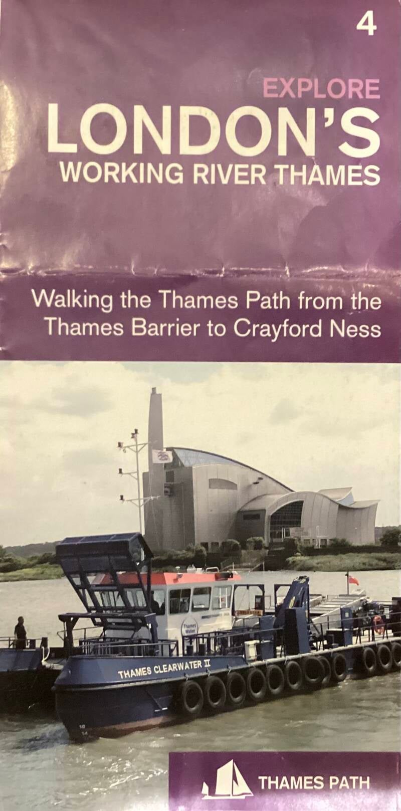
THAMES PATH: from WOOLWICH ARSENAL to CROSSNESS PUMPING STATION and on to ERITH, the RIVER DARENT and SLADE GREEN


History web

The Order numbers are from the LONDON GAZETEER
Brochure & map
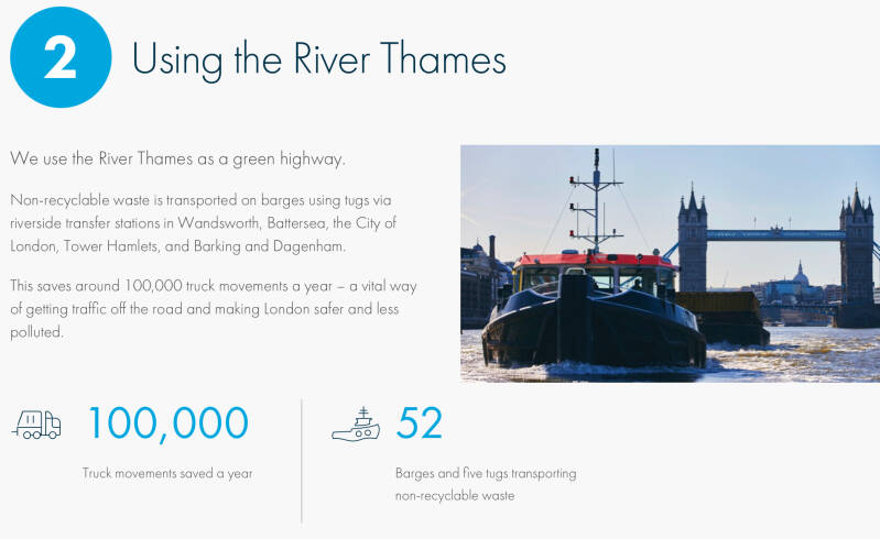
Still a busy waterway
Warships - galleons - liners: this stretch of the Thames is familiar with craft of every kind. Erith was a favourite port of call with Victorian pleasure steamers bound for Margate or Sheerness; at Woolwich, 18th century tourists even took boat trips to view the moored "hulks" of convict ships and watch gangs of prisoners building the Arsenal's protective walls.
Container ships, car ferries, waste disposal barges, police and pilot launches make up most of the traffic today. Keep an eye open for the distinctive red-ochre sails of traditional Thames Sailing Barges - the logo on the Thames Path sign. Once there were over 2,000 of them, trading along the rivers and creeks of the east coast. A handful remain as pleasure craft and may be spotted heading upstream to moorings. at St Katharine Dock, near Tower Bridge.
Wildlife: bring your binoculars!
Bring your binoculars for any walk/ride along this Path: after centuries of pollution, the Thames is now a living river in every sense of the word. 118 species of fishes are recorded in its waters, making this the cleanest big city estuary in the world. For spectacle on a grand scale, nothing may match the stranded whale photographed at North Woolwich in 1899 - yet this stretch of the Thames is busy with rewarding wildlife of every kind. On the water, cormorants, heron, shelduck, grebe, mallard and teal are a common sight while lapwing, dunlin and oystercatchers dabble in mud exposed at low tides. The damp habitat of the marshes, so perfect for storing volatile ammunition, now provide a sheltered hideaway for shy water voles and a winter refuge for teal, wigeon and a host of visiting birds.
GUARD HOUSES
ASSEMBLY. Artwork by PETER BURKE

This stretch of the river:Gallions Reach
Former Royal Arsenal Buildings alongside the route

Riverside route
Site of the GRAND STORE
Originally a grand quadrangle open to the Thames. stood here. A monumental classical composition, b.1806-14, traditionally attributed to JAMES WYATT and nephew LEWIS WYATT.
The most important surviving warehouses of the period in England are still here, but obscured by large buildings erected later in date.
W, S (long, particularly fine) and E RANGES. Great corner PAVILIONS. Rusticated ARCHES link ranges and pavilions. The E arch is missing though.
14a SHIPPING SHED
It blocks much of the view tow. Thames. 1860, reb.1890. The SHED to the E was demolished, part converted c.1970 to form a viewing platform (flood defences walls had been erected).
Wonderful views along/across the river.
14b Viewing platform
Jetties of 1872, reconstructed 1922.
3 Storehouses (c.1890) within the quadrangle
14c SHOT AND SHELL STORE (1806-13, altered 1856, c1890, 1972)
This is the only building surviving of the smaller quadrangles flanking the grand one. In fact, from the original building only lower storeys of N and S ranges.
Prominent brick TOWER, built as a WATER TOWER c1890 and part of the arsenal HYDRAULIC SYSTEM. This complex was used in later years by the BRITISH LIBRARY as storage space

Behind previous building
10 CHEMICAL LAB
Adjacent
Classical and especially attractive.
Original building, 1864: Recessed central section, 3 bays slightly projecting on either section.
Extension to the E, c1885.
West side: large room for chemical experiments, elegant gallery extending the full height
NAVAL OFFICES
Similar style. 1890. Upper storey added 1910.
15 THE BOILER HOUSE
On the site of the Eastern Court of the Grand Store. Prominent chimney, 2 oil tanks. 1968

To the S of the previous building
Small sections of tracks
Narrow and standard gauge

Along Wellington Avenue
19 MOUNTING SHED
Long, attractive single storey building, 1887, with a great series of round-headed windows. Guns were MOUNTED on their CARRIAGES here, that is why the entrance was purposely located opposite that to the ROYAL CARRIAGE FACTORY (bricked up).
A section of standard gauge railway track enters the building from the N.
Impressive interior, the original iron gantries for overhead travelling cranes were retained.
The most complete surviving industrial building on the site.
(S) 18 ROYAL CARRIAGE FACTORY
1802-05, and replacing an 18th c building. Impressive, massive. Gun carriages manufactured here.
Outer ranges relatively unaltered, except for late 19th c. extensions at the SE corner.
The core of the building was rebuilt in 1937, and again in 1968: a massive workshop covered by corrugated steel.
The N front is particularly impressive: corner pavilions, arches, pediment en centre mand cupola with a 1806 clock.
Grand entrance archways all sides except E.
(N) 11 CENTRAL OFFICES
Large and heavy Neo-Georgian building, 1903-11.
The main entrance, with the ROYAL CIPHER of ED.VII above, 1908. Through an archway to the N, with the royal arms, can be seen as eel framed lattice bridge across the courtyard.
In the fanlight over the main entrance used to be a stained glass window depicting “ED.III INSPECTING HIS ARTILLERY”, possibly late 16th, copied from an older tapestry. In 1750 it was in the fanlight of the ROYAL BRASS FOUNDRY
(N) 13 SHELL FOUNDRY GATEHOUSE
The only survival part of the build designed by DAVID MURRAY, 1856. Impressive, Barroque, with great arches and paired columns. DORIC below, IONIC above. The rest of the massive building was demolished in 1967.
Memorial area
Set up in 1974, it incorporates ironwork of 1854 from the Royal Laboratory.
12 DUKE OF WELLINGTON STATUE
1848. Thomas MILNER, escultor. Marble. Originally in the TOWER OF LONDON, it was brought to the RA in 1863
(S) 18A COMPLETING SHOP: FORGERS SHOP and TURNERS
1860. Substantially altered, late 19th and 29th cs
(S) 18B TIMBER SHED
1857. Grand long W range , with CORBELLED CORNICE. Impressive and little altered.
(S) Testing ramps for tanks
(N) 16 AMSTRONG GUN FACTORY
Handsome building, ITALIANATE style, 1856, David MURRAY.
Facing N, a long E shaped front, with polychrome brick detail.
The main range, apart from the PORCH was raised in 1911.
Along the N front, IRON PLATES to reinforce its internal structure.
The building was essentially a frame for six gantry frames supported on substantial IRON PIERS.
To the S, 1968 extension. Used by the BR.LIB. for storage, until recently.
This building was the focal point of a complex which comprised the ROYAL GUN FACTORIES. The only other building to survive from this complex was the ROLLING MILL, to its E. The other buildings were demolished in the 70s.
(N) 16a ROLLING MILL
1868. Iron-framed, clad in green corrugated iron, in 1890 and later years.
Standard gauge railway tracks
(S) 17 MIDDLE GATE HOUSE
Attractive, with a Doric porch. Originally the Storekeepers House, 1809. Large extension to the rear, 1938
(S) 17A MIDDLE GATE
Originally, PLUMSTEAD GATE. 1843. Vermiculated piers

Back to the THAMES PATH
Former COALING PIER
BROADWATER. Royal Arsenal Canal (aka Ordnance Canal aka Pilkington Canal)

Convict labour formed part of the Royal Arsenal’s labour force to construct a 2.5 mile boundary wall around the site. These convicts were housed on three redundant ships known as prison hulks moored on the Thames near Woolwich. In 1812-1816 these convicts were used to dig a canal designed by Lieutenant Colonel Pilkington. The canal was built for a dual purpose - one was to deliver materials into the Royal Arsenal complex and the other was to create a defence boundary to the east. The history of the canal has been difficult to research as the layout of the complex was not shown on maps and photographs rarely taken due to the secretive nature of its work.
PRINCESS ALICE WAY. Remembering the 1878 river disaster

TIMBER SLIPWAY
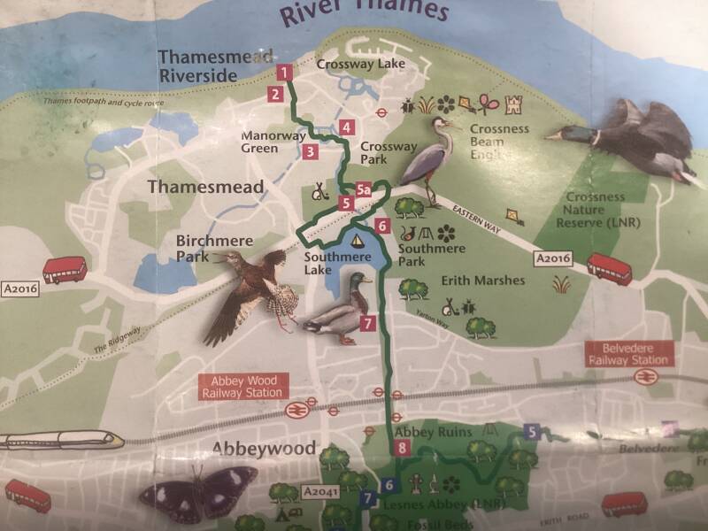
Welcome to THAMESMEAD
straddling the border between Most of the land area of Thamesmead previously formed about 1,000 acres (4.0 km2) of the old Royal Arsenal site that extended over Plumstead Marshes and Erith Marshes.
Nearby
Nearby
PLUMSTEAD
Nearby
GALLIONS PARK & LAKE

TRIPCOCK NESS
MARGARETNESS LIGHTHOUSE
PILL-BOX, WW2
A concrete box covered in graffiti — it’s a relic from WW2. Nicknamed pillboxes, these were part of the last line of defence for London should the UK have been invaded.
Across the river, BARKING: BARKING CREEK. Drop-gate flood barrier
Although the Thames Barrier is the most famous of London’s flood defenses, it’s only one of 36 industrial floodgates built to protect London — and one of the more distinctive is the Barking Creek Barrier.
THAMESMEAD PUMPING STATION
Site of the boat PRINCESS ALICE accident
Generations of Londoners have loved their day trips down the Thames. On the evening of 3rd September 1878, a holiday jaunt turned to disaster. The paddle steamer Princess Alice was returning upriver from Sheerness crammed with 800 passengers when she collided with the steam collier Bywell Castle and sank in under four minutes, just yards from the bank off Tripcock Ness. Some 600 people drowned in the calamity described in local records as the "Greatest Affliction of the Age". The report continues: "The fearful suddenness of the catastrophe, the social condition of many of the victims, the awful proportions of the death-roll and the new peril which seemed to come home to all the thousands who were wont to travel by water - all contributed to the horror of an event which shook Great Britain like an earthquake and sent a shudder vibrating through the world."
Nearby
WEST LAKE & EAST LAKE
”TOWN CENTRE”
EATERIES, MORRISONS SUPERMARKET
Further inland
BIRCHMERE & BIRCHMERE PARK

The Green Chain Walk STARTS HERE
Thames Path
CANNONS
CROSSWAYS LAKE
CROSS NESS LIGHT
An unmanned lighthouse on Crossness is a navigational aid to shipping. Crossness lighthouse is a steel lattice structure, built 1895 by Trinity House, now operated by the PLA.
The light is at an elevation of 41 feet (12.5 m) and gives a white 5-second flash visible for 8 miles (12.9 km). In 2024, the Port of London Authority consulted on replacement of the lattice structure with a light on a drop-down mast.
SITE of the old PORT OF LONDON
Current PLA jurisdiction
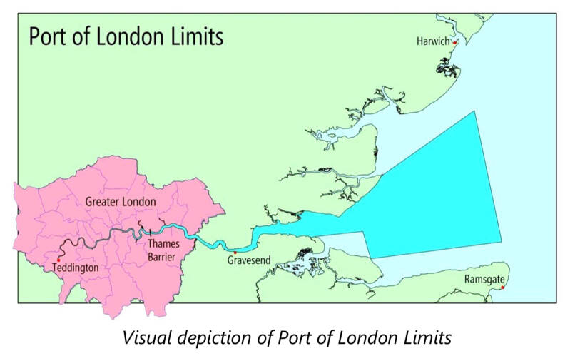
The Port of Tilbury and the DP World London Gateway, are the real current ports…

The Port of Tilbury is a port located on the River Thames at Tilbury in Essex, England. It serves as the principal port for London, as well as being the main United Kingdom port for handling the importation of paper. There are extensive facilities for containers, grain, and other bulk cargoes. There are also facilities for the importation of cars. It forms part of the wider Port of London.
DP World London Gateway is a port within the wider Port of London, on the north bank of the River Thames in Thurrock, Essex. Opened in November 2013, the site is a fully integrated logistics facility, consisting of a semi-automated deep-sea container terminal which is on the same site as a land bank for the development of warehousing, distribution facilities, and ancillary logistics services.
The facility is located 30 miles (48 km) east of central London. The deep-water port is able to handle some of the largest container ships in the world. On a weekly basis, the port is now linked with 51 countries and more than 90 ports all over the world,
Navigating on the Thames


HISTORY and much more : https://www.trinityhouse.co.uk/about-us
Cross Ness
Cross Ness, a specific promontory on the southern bank of the River Thames. In maritime terms, the tip of Cross Ness, in the past referred to as 'Leather Bottle Point', marks the boundary between Barking Reach and Halfway Reach.
Diamond Geezer has surveyed the area…

GOLF COURSE?
Artworks?
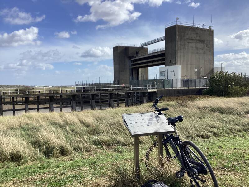
Former CROSSNESS PUMPING STATION


A former sewage pumping station designed by the architect Charles Henry Driver for the Metropolitan Board of Works's chief engineer Sir Joseph Bazalgette.
It is located at Crossness Sewage Treatment Works, at the eastern end of the Southern Outfall Sewer and the Ridgeway path in the London Borough of Bexley. Constructed between 1859 and 1865 by William Webster, as part of Bazalgette's redevelopment of the London sewerage system, it features spectacular ornamental cast ironwork, described by architectural historian Nikolaus Pevsner as "a masterpiece of engineering – a Victorian cathedral of ironwork". It was decommissioned in 1956. Subsequently the building has been extensively restored and was opened to the public in 2016.
MODERN WATER TREATMENT WORKS
The Crossness Sewage Treatment Works is a sewage treatment plant. It was opened in 1865 and is Europe's second largest sewage treatment works, after its counterpart Beckton Sewage Treatment Works located north of the river. Crossness treats the waste water from the Southern Outfall Sewer serving South and South East London, and is operated by Thames Water. The treated effluent from the plant is discharged into the River Thames at the eastern end of the site.

Buses to/from Erith

Belvedere railway station
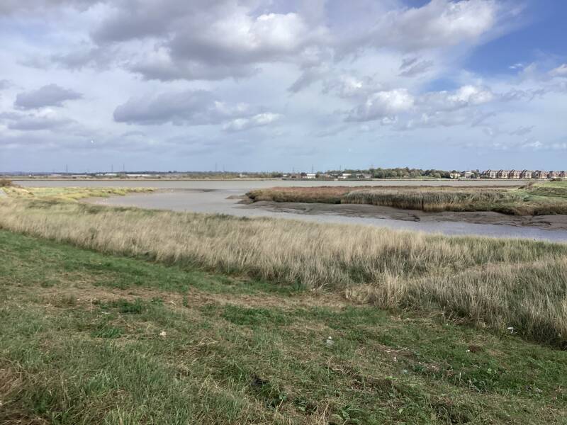
Former grazing land

The bulk of the marshes which once existed from Woolwich to Erith have now been built upon. The small part that remains is owned by Thames Water, who manage an award-winning wildlife area.
ENERGY from WASTE: two facilities, RIVERSIDE 1 & RIVERSIDE 2
The extraordinary silver building with a curvaceous chimney belching steam into the sky is the Crossness Sewage Incinerator. It's become a landmark on the estuarine horizon for miles since it was opened by Prince Philip in November 1998. Here raw sludge cake is combusted at temperatures up to 950°C, then cleaned of pollutants before being ejected, and however amazing it looks the underlying process is very much not nice. A sign here announces that you've just entered the Belvedere and Erith Marshes,
DISMOND GEEZER: “the Riverside Resource Recovery Facility, a swoosh-topped chamber which turns London's waste into useful energy. A lot of this comes in by barge via the stonking great pier with its orange cranes, though hopefully not while you're here because that would block your onward progress. The RRRF generates up to 72 megawatts of electricity which is a dozen times better than the sludge incinerator, and is so successful that a second plant is just about to be built nextdoor, hopefully coming online in 2026. No authority would dare construct anything like this in Richmond or Wandsworth, but here in liminal Bexley there's plenty of space to hide all this and a whole lot more.”
The LONDON MAYOR said, though: https://www.london.gov.uk/press-releases/mayoral/stop-allowing-new-toxic-waste-incinerators


Riverside 1, one of the UK's largest energy from waste (EfW) facilities, in Belvedere, London Borough of Bexley. The facility processed 782,000 tonnes of non-recyclable waste in 2021, diverting it from landfill and saving 133,000 tonnes of CO2 from being released into the atmosphere.[2] In the process, 532 GWh of baseload electricity was generated and 170,000 tonnes of ash were turned into aggregate for construction.[1] (As of April 2025, a second EfW facility, Riverside 2, was under construction at Belvedere.)
In 2020, Cory received planning permission to build a second EfW facility, Riverside 2, adjacent to its existing one in Belvedere.[53]The company is also developing a district heat network at Belvedere with Vattenfall.[54] Construction of Riverside 2 started in early 2023 and the plant is scheduled to be completed and operational in 2026.[55]
In 2021, Cory announced plans for one of Europe's largest Carbon Capture and Storage (CCS) facilities in Belvedere,[56] with a planning application for the facility following in late 2023.[57][58][59][60][61][62][63][64][65] The proposed development was expected to take up to 11.7% of the 25.5 hectares of land at the adjacent Crossness Nature Reserve. A campaign group and petition was established in December 2023 to oppose the development.[66][67] The petition generated 2,790 signatures. In June 2024, the campaign group sought to raise £8000 to fight the plans.[68]
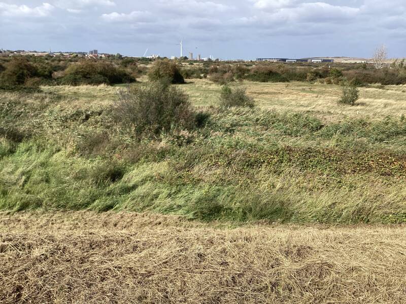
CROSSNESS NATURE RESERVE


An impressive variety of rare species in protected area for wildlife (members only).
From water voles to bumblebees, all kinds of rare wildlife make a home at Crossness. You might spot England’s rarest bumblebee, the shrill carder bee. You might also see the scarce brown-banded and moss carder bees.
There are also rare dragonflies, such as Lesser Emperor and Norfolk Hawker. There are a host of butterflies and other invertebrates, too.
Threatened?: https://www.savecrossnessnaturereserve.org
Logistics: ASDA, LIDLE, AMAZON OCADO… warehouses
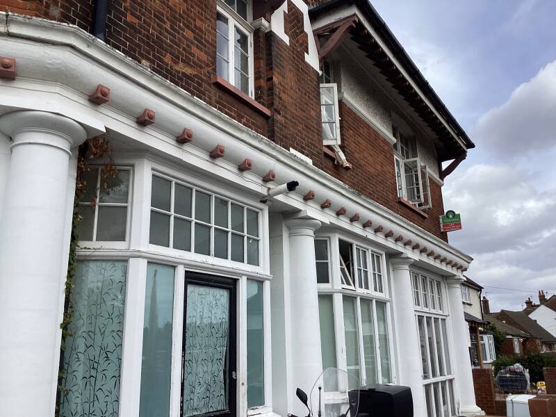
WELCOME to Erith!
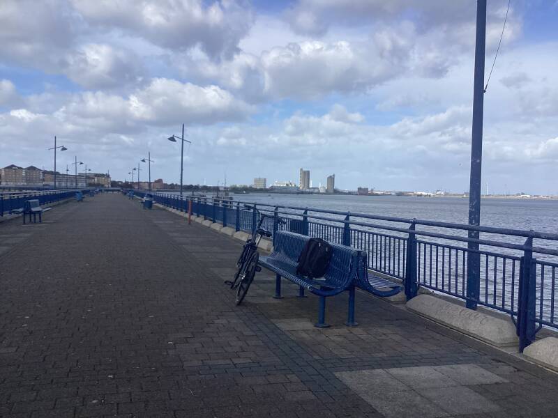
William Cory Promenade
Riverside Gardens
Erith Town centre

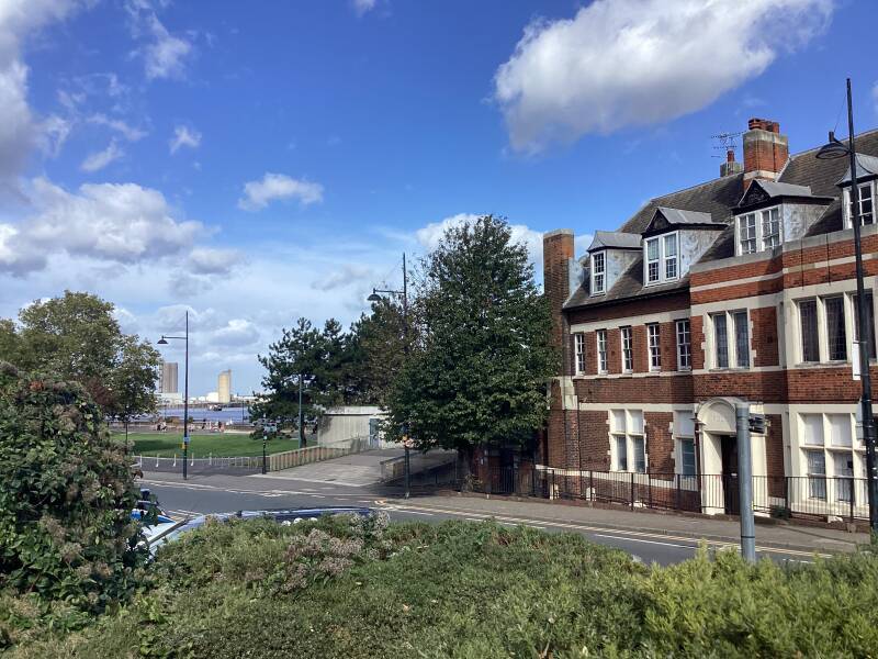
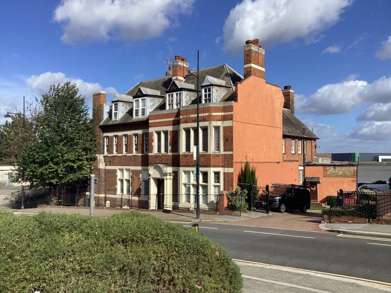
Former POLICE STATION

Cottages

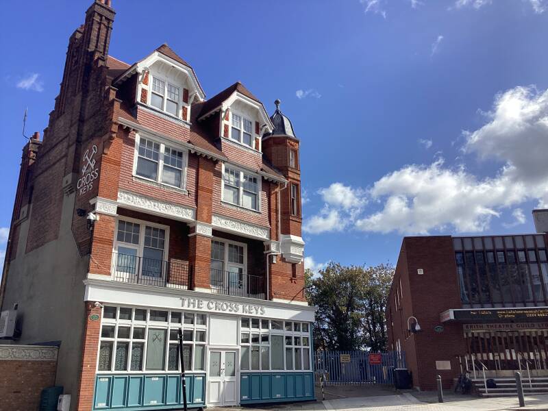
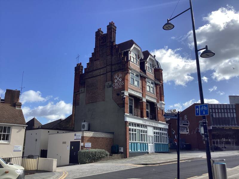
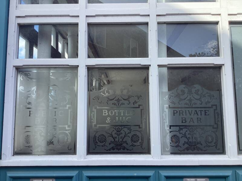
Former THE CROSS KEYS


ERITH PLAYHOUSE

Former THE WHITE HART

Erith PIER and deep water JETTY


The bridge fron the pier


On the BARKING & DAGENHAM side
RAINHAM MARSHES, N bank of the THAMES (LB OF BARKING and DAGENHAM)

COLDHARBOUR LIGHT
River Cray Way starts HERE (The actual river does not start here!. See later)

The River Cray is the largest tributary of the River Darent. It is the prime river of outer, south-east Greater London, rising in Priory Gardens, Orpington, where rainwater percolates through the chalk bedrock of the Downs to form a pond where the eroded ground elevation gives way to impermeable clay.
Appold Rd
Manor Road
Industrial site: logistics, car repair workshops, car breakers
BEXLEY BREWERY

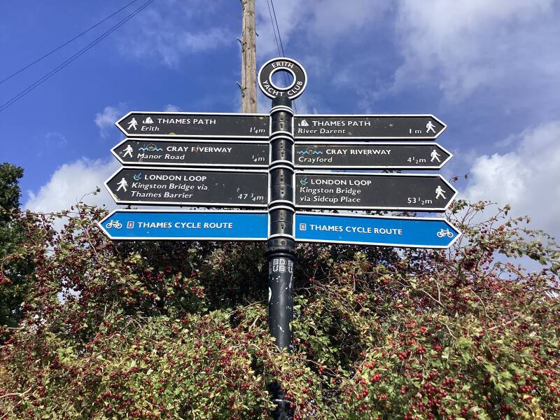

ERITH YATCH CLUB


Crayford and Dartford Marshes


ERITH SALTINGS


The last remaining bit of salting marshes on London’s Inner Thames. At low tide, remnants of a ghostly forest are sometimes visible on the foreshore.
CRAYFORD NESS LIGHT
The QE II BRIDGE… only a bridge?


The Queen Elizabeth II Bridge is part of the Dartford Crossing over the River Thames in the UK, connecting Essex and Kent and serving the M25 motorway.Opened in 1991 and named after the Queen, this cable-stayed bridge carries all southbound traffic across the river, allowing the two existing tunnels to handle northbound traffic. It is the only fixed crossing of the Thames east of Greater London and is known for its high usage and frequent congestion, with a tollcharged electronical
There is here more than a bridge: the DARTFORD CROSSING
The Dartford–Thurrock River Crossing, commonly known as the Dartford Crossing and until 1991 the Dartford Tunnel, is a major road crossing of the River Thames in England, carrying the A282 road between Dartford in Kent in the south and Thurrock in Essex in the north.
It consists of two bored tunnels and the cable-stayed Queen Elizabeth II Bridge.
Munition factories, here?. Yes, a Trench Warfare Filling Factory by the Ministry of Munitions

Construction started: 21 August 1915. Opened: 9 October 1915. Area: 14 acres. Management: Thames Ammunition Works. Munitions: filling 2in and 6in mortar shells. Notes: built close to the Thames Ammunition Works.
1879 The works were founded, on the spit of land between the Thames and the Darenth Rivers.
1897 The Thames Ammunition Works were completely wrecked by an exceptional high tide, being for the most part under water.[1]
1902 Acquired by the Company (presumably Armstrong Whitworth). The works covered a site of about 40 acres. [2]
1956 An explosion in a waste powder room at the Thames Ammunition Works, Slades Green, near Erith, Kent[3] of Vickers-Armstrong Ltd.[4]
A radar?

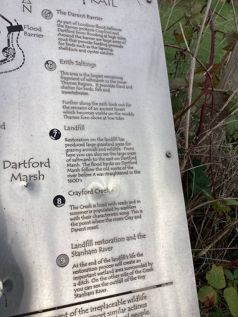
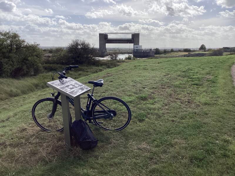
RIVER DARENT FLOOD BARRIER


Along the embankment, near the bank of the Darent following the Cray River Way or the London Loop


You are branching right and heading to SLADE GREEN. The CRAY RIVER WAY continues its route.
Train Depot


HOWBURY MOAT

The barn is 17th or earlier. The doorpost has the remains of a mechanism to adjust the shutters during winnowing.

Howbury Moated Grange. This is a 12th moated manor site once the home of a Tudor official, later rebuilt. The Norman moat encloses the manor house - a 17th building now damaged beyond repair. The wall of the moat is still there but the drawbridge was replaced by brick one in 1778 which has now collapsed. Occupants of the property were latterly tenant farmers, and after the building of a new house - Howbury Grange to the south - in 1882 the building was abandoned in the 1930s.
WELCOME to Slade Green town centre!


You are still in Greater London (London Borough of Bexley) but around 14 miles (23 km) east-southeast of CHARING CROSS. Historically Slade Green was part of the county of Kent. In 1965 it became part of the new ceremonial county of Greater London.
ERITH railway station

Hazel Road


Next: why not cycling from SLADE GREEN to BEXLEYHEATH, then towards Central London, or to ABBEY WOOD (Elizabeth Line)?


Enjoying this guide and the route?

Why not donating or volunteering?

Amazing web https://www.ianvisits.co.uk

